Ilsington to Haytor
Time: 3 hours Distance: 8 miles
Introduction
No walking book of Devon would be complete without a route featuring the famous Haytor Rocks -undoubtedly one of the most well known landmarks on Dartmoor. We begin our excursion from the pretty village of Ilsington and make our way up onto the moor with its expansive views at Black Hill. Taking in some interesting industrial archaeology at Haytor Quarries we finally achieve the summit at Haytor Rocks with its fabulous all round panorama – this has to be a walking highpoint in all senses! We reluctantly descend from the moor to return to our start through charming country tracks and lanes brimming with wild flowers and luscious foliage.
Access by car: Take the A38 from Exeter towards Plymouth and at the Drum Bridge A382 junction take the third exit signed to Ilsington. After 500yds turn right and follow the road for 2miles to Ilsington parking on the road in the vicinity of St Michaels Church.
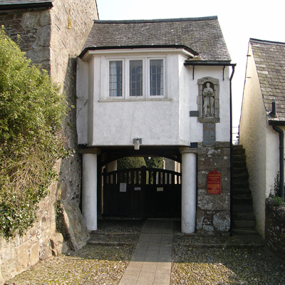
We start the walk from outside the Carpenters Arms pub taking the path alongside the pub into the churchyard and turning left past the church out onto the road via the magnificent West Lych-gate.
From the gate we turn right, then left at the t-junction heading out towards Haytor reaching Vicarage Cross after 100yds and taking the right turn on a narrow lane signed Trumpeter. The small hamlet is reached after 500yds where we bend right past cottages then, just past the last cottage as the road swings right, we continue straight, on a No Through Road signed to Smallacombe Farm.
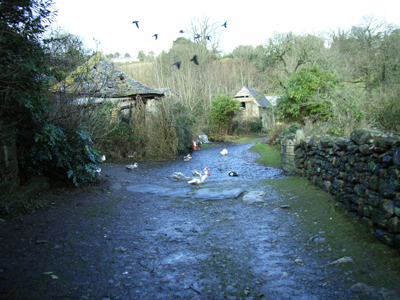 The small lane gently climbs between high hedges and fields to the farmyard alive with a variety of hens, ducks and guinea fowl happily scratching around. We make our way through the farm buildings crossing a small ford and up to a cross tracks where we turn left on a bridleway passing through a gate then immediately right on a signed footpath to the moor. Extensive views down to the coast at Teignmouth open up on the right as we climb the muddy track which soon turns into an access lane at a couple of cottages on the left and levels out as we reach the drive to Shotts House. With a right/left dogleg and then through a gate we clamber up a bank onto the main Haytor Road which we cross taking the small muddy track ahead then turning right parallel to the road on a wider grassy track. After 100yds, opposite the Green Lane road junction, we take a sharp left turn to start the climb onto Haytor Down picking our way through heather and gorse on a well used peaty path.
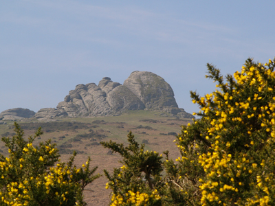
The imposing silhouette of Haytor Rocks dominates the view (SW) as we make our way up to a road ahead. Ponies and sheep watch lazily as we cross into a parking area from where we bear right (NW) on a narrow path heading for a small boundary stone visible on the near skyline. Below us on the right Yarner Wood and Trendlebere Down lead our gaze down into the steep Bovey Valley with Lustleigh Cleave on the far side. We take a short diversion right from the path to the boundary stone inscribed ‘Old Jack’ which is one of a series of stones erected by the Duke of Somerset around his land in 1853. Rejoining the path we continue soon seeing the next boundary stone in the series, ‘Victoria’ from where we contour around the hillside then climb steadily to the Black Hill cairn.
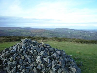
From this eastern edge of the moor we get excellent views of beautiful rolling Devon countryside, Haytor still dominating our view south and we set off from Black Hill directly towards the rocks on a wide track passing a second cairn. We continue south picking anyone of many paths cutting their way through the heather down to the Granite Tramway in the valley below Haytor and follow Tramway left (E).
The Haytor Tramway, built in 1820 by George Templer, was used for 10 years to carry stone, some for the new London Bridge, down to the Stover Canal 8½ miles away at Ventiford. The tramway is constructed from granite setts with a flange cut into them to hold the iron shod tram wheels; remarkably, granite points have been carved to allow branch lines to join with the main track. The stone was carried on trucks by gravity downhill 1300ft and horses were used to return them empty back to the quarry.
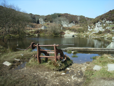 Where a branch line joins the main track at a set of stone points we take the branch gently curving left towards the most easterly of the rocky spoil heaps marking the position of Haytor Quarries. Adjacent to the heap we turn right on a grassy path climbing up to the quarry with a small stile leading us on a stony path into the sheltered enclosure – an excellent place for a picnic. Skirting the edge of the small lake we search for its elusive goldfish before exiting at gate and turning right for the steep climb to Haytor Rocks. It’s always worth spending a few moments here exploring and climbing the outcrops, wondering at the extensive views whilst being entertained by others rock climbing, flying kites and playing hide and seek. We leave the Rocks (S) down the well worn grassy ‘motorway’ to the road and car park clearly visible below then, over the road, we take a track on the right of the carpark (S) leading alongside the shallow valley on the right.
Reaching a stone wall just before Bag Tor, we turn left (E) on a path alongside the wall and continue down through disused mine workings to the access track to and from the moor (Wp.17 133M). Our way runs along field boundaries between high Devon banks then drops steeply through conifers into a deep valley with a clapper bridge and ford across a small stream. Over the stream we head out on a broad track past a newly planted wood meeting a lane where we turn right. We carry straight on at Birchanger and Sigford Crosses then bear right at Swinepark Cross to follow the lane down to Five Cross. Here we turn sharply left taking the well rutted muddy ‘green lane’ squeezed between high hedges. At a cross tracks we turn left (N) back towards Ilsington soon dropping steeply down the notorious Simms Hill before climbing up to the village and taking the first turning right back to the Carpenters Arms and our car.
Simms Hill at Ilsington is one of the most severe hill climbs featured in the Motor Cycling Club’s annual Exeter Trial which takes place over two days early in January. The trial has been a regular event since 1910 and involves motorcycles and cars attempting to complete the route which includes a series of ferocious hills. Simms Hill was introduced into the trial in 1933 and is regarded by some as the most challenging – it’s great fun to watch the intrepid crews bouncing and scrambling their way up (and all too often down) the rough, steep incline in their often interestingly customized transport.

